-
DP connects
organizations of all kinds with
the world's leading CAD Experts. -
Our Clients :


-
We are a member of :


GIS Conversion
Design Presentation provides GIS (Geographic Information System) services to a wide range of companies, including companies that focus on transportation (road and water), telecommunication, mining, electricity and power.GIS can be thought of as the high-tech equivalent of a map. The reach of Geographic Information Systems extends into all disciplines, ranging from prioritizing sensitive species habitats to determining optimal real estate locations for new businesses. Design Presentation creates separate layers to facilitate a better understanding of a particular geography. We can create layers according to your guidelines. GIS can be used for Urban Infrastructure Planning, Water Resource Mapping and Monitoring, Civil Engineering Mapping, Contour Mapping and Detailed Forest Mapping.
The DesignPresentation team digitizes drawings, maps, and documents and converts them to vector formats in order to link them with databases. We provide accurate, fast and cost-effective digitizing/vectorization transformation to GIS systems.
The array of services provided by DesignPresentation includes
• Aerial triangulation/Stereo Orientation
• DTM generation
• ArcExplorer and ArcView Training
• ArcView Applications Development
• Contour Mapping (Digital Elevation Models (DEM))
• Custom Mapping
• Parcel Mapping
• Data Automation and Integration
• Feature Extraction
• Geo-coding of databases
• GIS Mapping related to local area planning
• Land use mapping
• Local Area Planning (District Planning Maps, Census Maps, etc.)
• Photogrammetry
• Spatial Analysis and Modeling
• Utility Mapping
All of the above GIS work is performed with the latest GIS technology, which helps us produce drawings that are precise, accurate and minutely detailed.
We also offer such services as:
• Civil Engineering Mapping
• Contour Mapping
• Detailed Forest Mapping
• Flood Interpretation
• Geo Engineering Survey
• Geological Mapping
• Irrigation Management, etc.
• Urban Infrastructure Planning
• Water Resource Mapping and Monitoring
Background Information on GIS
GIS is a rapidly growing technological field that incorporates graphical features with tabular data in order to assess real-world problems. This amazing technology was developed in 1960 with the discovery that maps could be programmed using simple codes and then stored in a computer, allowing for future modification whenever required. Geographic Information Systems were a welcomed change from when maps had to be painstakingly created by hand; even small changes required the creation of a new map. The capabilities of GIS are a far cry from the simple beginnings of computer cartography. At the simplest level, GIS can be thought of as an electronic map. However, the storage of data in an easily accessible digital format enables complex analysis and modeling that was not previously possible.
We are confident that we can help you address your most challenging GIS problems. We help our clients evaluate, select, and implement the best solutions because we utilize the best technologies available. DesignPresentation’s Geographic Information Systems department is constantly updating our already advanced technologies so that we can provide you with the most cutting-edge service.
Contact us today for a free quote
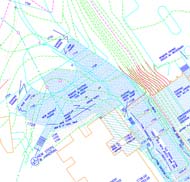
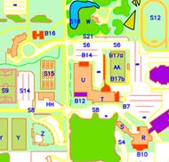
GIS Mapping (Portfolio Samples)


